
You hear so much about the Victorian High Country, but unless you’ve grown up around there you never know what to expect. I can tell you it’s well worth the effort. From lush riverside campsites, great 4wding to suite all levels of experience and awesome views as far as the eye can see – and we hardly covered any of it!

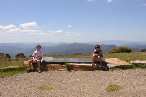
View at Craig’s Hut – Alpine National Park
Getting There
Located 1,579 Km’s SSW of Brisbane via the Newell Hwy, 768 Km’s SWW of Syndey or just 228 Km’s NNE of Melbourne, you can access the National Park by two wheel drive. The Alpine National Park is very large and there are a large number of areas to explore. We headed for the small town of Mansfield and then towards Mt Buller on Mt Buller Rd. Take a right hand turn onto the Howqua Track (signed). The Howqua Track is a dirt road but easily done in a two wheel drive vehicle. Along this track you will come to the popular camping area of Sheep Yard Flat. This was originally our destination (based on research from home) but when we arrived we were disappointed and kept looking for somewhere better. So we continued along the Howqua Track and finally settled on a smaller camping area – Tunnel Bend!
Experience
We were using this trip as test to understand how difficult it was to traverse the High Country. Books we had referenced tracks that were easy, medium, difficult etc but from 1500 Km’s away it was hard to tell what that meant.
So we allocated 6 days to explore a small area of the High Country. We setup our tent underneath the shade of some trees, right in front of a private 10 metre walkway down to the Howqua River. Our stay was during December, the week before Christmas and we had the place basically all to ourselves. Well, except for one bloke Alan who had been coming here for a month every year for the last 25 years.
Tunnel Bend Campground – Alpine National Park
While I was getting everything sorted the wife and kids went for a look around. They came back super excited because up at the end of the camping area they’d found a “Magic Waterhole” with a small water fall. Before the tent was up they were off having a swim in the midday sun. Fortunate for us the weather was warm – between 30 and 35 degrees in the valley which meant you could enjoy the cool water for a good hour before having to hop out and warm up in the sun again.
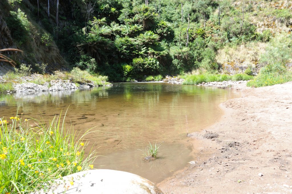
Howqua River – Tunnel Bend – Alpine National Park
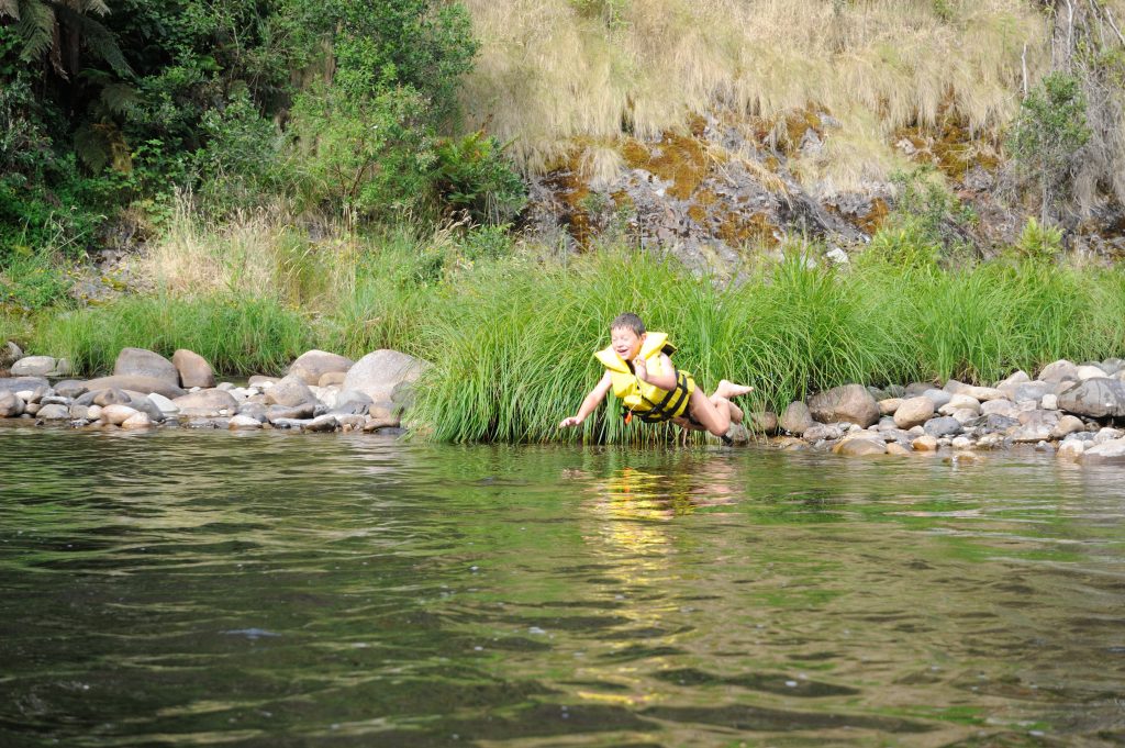
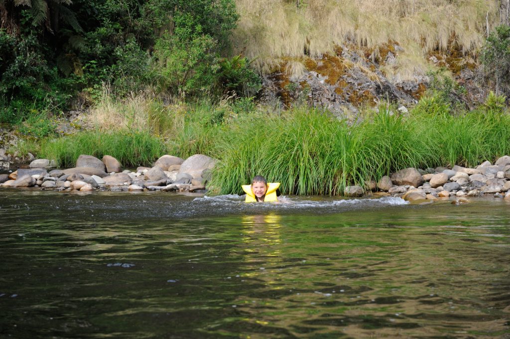
Our kids loved swimming here. On days we stayed in camp 3-4 hours each day were spent swimming and floating in the river. With tears everytime we had to leave! 🙂 As we drove through the town of Mansfield I saw a sign advertising truck tyre tubes for $10. Make sure you grab one or two as they would be perfect for lounging around in or drifting down the river.
-
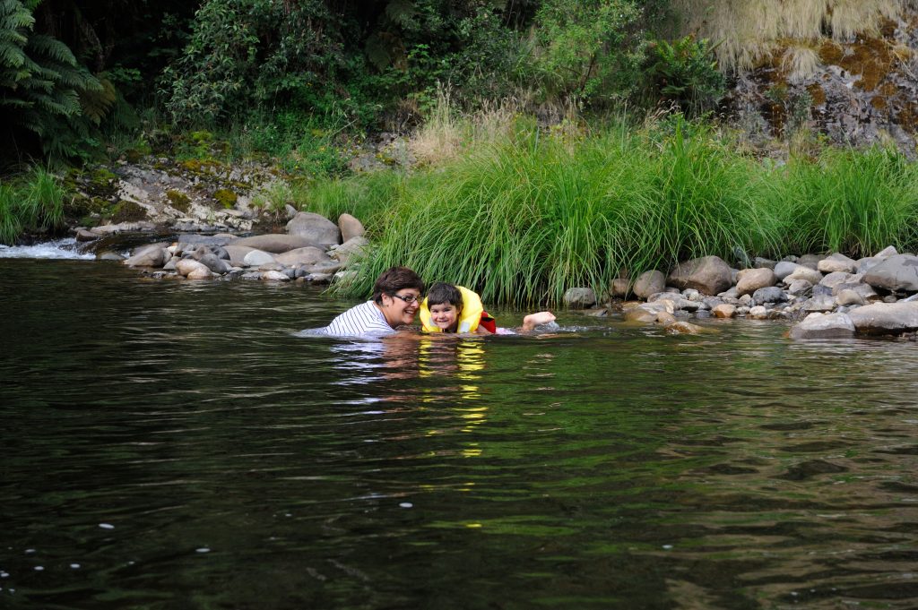
- Swimming in Howqua River – Tunnel Bend – Alpine National Park
-
- Swimming in Hawqua River – Tunnel Bend – Alpine National Park
-
- That’s Gold – Tunnel Bend – Alpine National Park
-

- Walking back after swim – Tunnel Bend – Alpine National Park
Despite camp being rather warm during the day, nights were still very cool. So you need to come prepared. Keeping warm before bed and in the morning is helped by the fact that you can collect firewood in the National Park. You aren’t allowed to pull trees or branches down, but can freely collect fallen timber from the ground. We found that there wasn’t much to collect within the first 5 km’s of the camping area but after that it was quite easy to find in abundance.
Not knowing much about the high country, I spoke to Alan, the bloke we met while setting up. What a legend! He sat with me for an hour and gave me guidance on where I could head safely (as we were on our own), as well as where I could get a little more adventourous if I wanted to depending on how I found the tracks. I didn’t realise it at the time, but this end of the High Country has the highest concentration of cabins compared to other areas. So we set about exploring and seeing as many of them as we could.
Craigs Hut and Surrounds
First day out we decided to make our way towards Craigs Hut. This was a relatively easy drive with a couple of steep hill climbs. It starts by continuing along the Howqua Hills Track driving further into the National Park. Turn left at Brocks Road. All this is easy in two wheel drive with great scenery. It improves as you come to a steep (but easy) climb up the side of the hill via a number of switchbacks. The slow pace up gives you time to enjoy the scenery.
Not long after the switch backs you’ll come across Eight Mile Gap. Turn left and take the Bluff Link Road Track. The driving starts to get a little more interesting but still easy. At the end of this track turn left to stay on Bluff Link Road (head towards 16 Mile Jeep Track). When we did this the Bluff Link Road was closed at the intersection so we took the 16 Mile Jeep Track. This was awesome with a steep clay descent that will definitely have you in low range. If it was raining you’d definitely think twice about coming up this way unless you like winching! The track was in really good condition but the steep slope was covered in deep clay. Finally the driving was getting as good as the scenery!
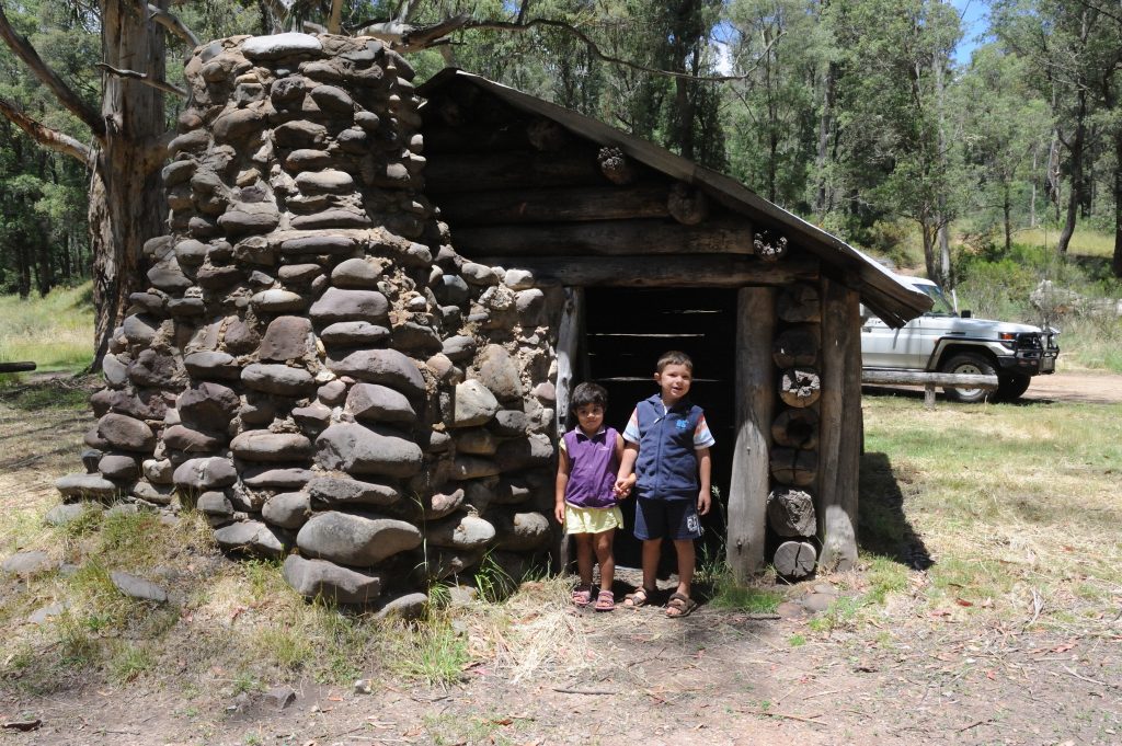
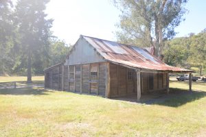
Bindaree Hut – Alpine National Park
Down the bottom of this track you’ll come across Bindaree Hut. It’s a good opportunity to get out and stretch the legs before getting into some better 4WDing. After leaving the Bindaree Hut continue along the 16 Mile Jeep Track and turn left onto Bindaree Road. At the end of this take the Monument Track. This is a nice long, steep climb. Depending on when it was last graded, this track will have you crawling up small – medium boulders. It’s still an easy track but a bit of fun without any risk. At the top of the Monument Track turn right onto Clear Hills Track and Criag’s Hut is just around the corner!
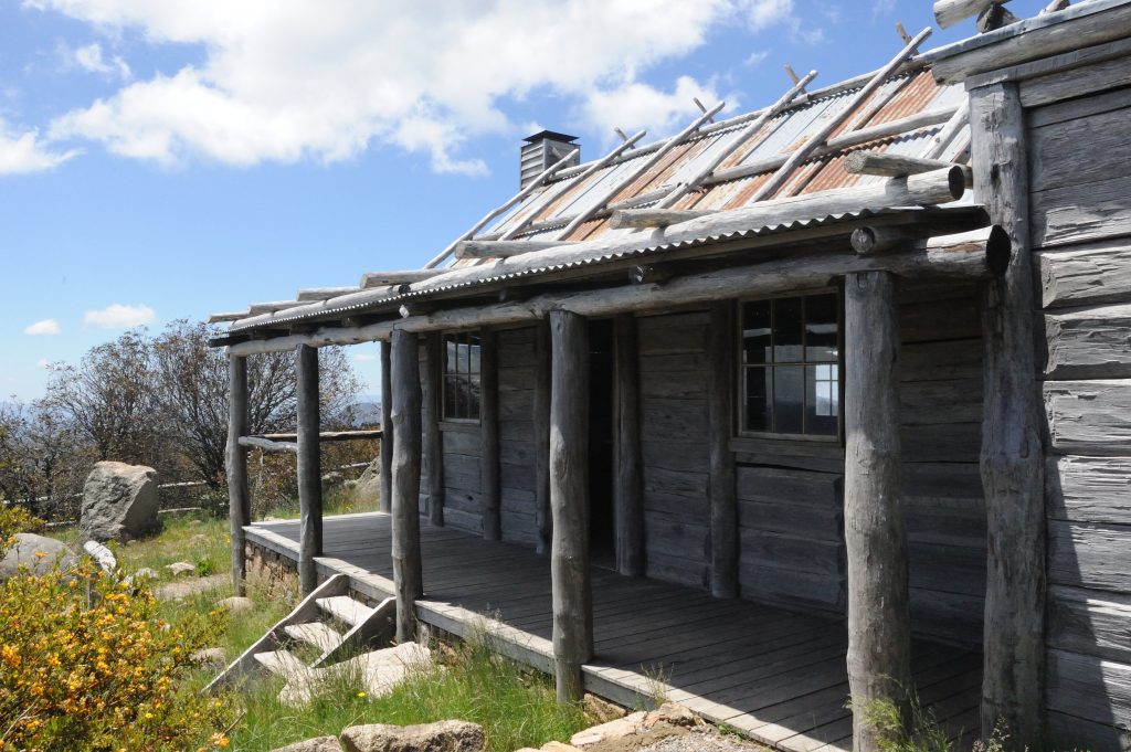
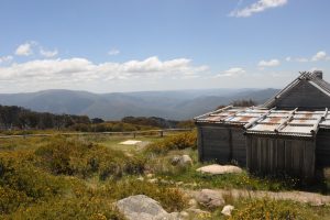
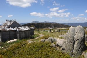
Craig’s Hut – Alpine National Park
Craig’s Hut is the perfect spot to have lunch with tables and open areas readily available. The view here is one to be remembered and makes you realise why people are passionate about the High Country! I’ve never seen a view that seemed to go for every anywhere like it in Australia. The Hut that stands today is not the original hut. In fact, it’s the third. The original was made for the filming of “The Man From the Snowy River” which quickly fell apart after filming. It was then reconstructed and stood until bush fires burnt it down in 2006. The Victorian Government then rebuilt it in 2007.
-

- Craig’s Hut – Alpine National Park
-
- View at Craigs Hut – Alpine National Park
-
- View at Craigs Hut – Alpine National Park
-
- View at Craigs Hut – Alpine National Park
We stayed at Craig’s Hut for a while as the kids enjoyed being out of the car and it was a cracker of a day. Although it was around 35 – 40C back at our campsite, it was a very cool 25C on the top of Craig’s Hut which caught us a bit by surprise. Help’s you appreciate how much of a climb the Monument Track was! 🙂
Given it had taken us 4 hours to drive to Craig’s Hut from Tunnel Bend and we were on our own, we figured we’d take the easiest way back home. So we headed back down the Clear Hills Track towards Howqua Gap Hut.
-

- 2006 Fire Damage – Clear Hills Track – Alpine National Park
-

- 2006 Fire Damage – Clear Hills Track – Alpine National Park
Along the way we came across this view. The fires in 2006 were so intense that it literally boiled the bark on the trees and killed them. The new growth was only two – three metres high so you could see one side of the hill (Wind fanned) where the trees were all dead and the other side which must have burnt cooler with old growth. I wouldn’t want to get caught out here next time they have a large fire event as their will be plenty of fuel. I would also think fallen trees across tracks are likely to increase as these trees break down.
Once you get down near Howqua Gap Hut, follow Cornhill Road up to the black top just below Mt Buller. From here head back to Tunnel Bend the way you went in before.
Fry’s Hut, Mitchells Homestead, Upper Jamieson Hut
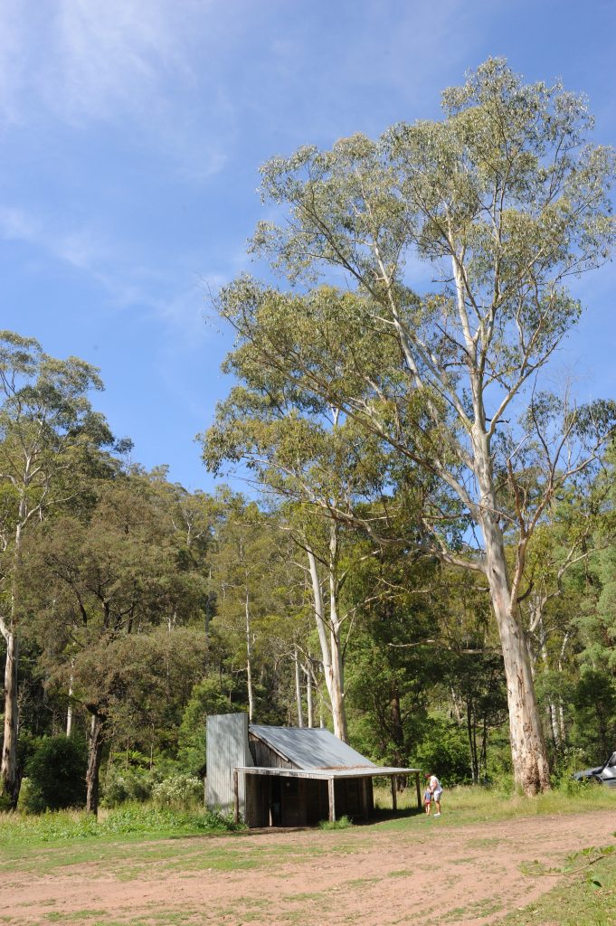
Our second day out and about Alan suggested a course that would take in a couple of cabins and an old mine. From Tunnel Bend we headed back towards Sheepyard Flat camping area along the Howqua Hills Road. When you get there take a left onto the Howqua Hills Track. Fry’s hut is just a short drive and you’ll come across another camping area.

Fry’s Hut – Alpine National Park
-
- Fry’s Hut – Alpine National Park
-
- Fry’s Hut – Alpine National Park
-

- Fry’s Hut – Alpine National Park
Back in the car you continue heading along the Howqua Hills Track until you come to Steiners Road. Take a left here towards the Slate mine. Here the 4WDing starts although it’s still simple due to the roads being in reasonable condition. We used low range 4WD instead of going between high and low all the time. Afer a while you’ll come to the intersection of Mitchells Track. Turn left onto Mitchells Track and head towards the Slate Mine. Slate from this mine used to be carried out by horse and cart. After the drive in, that would have been hard work and gives some perspective to the perceived difficulties of modern life.
From the Slate Mine, continue along Mitchells Track towards the Mitchells Flat Camping area. On this part of the track you descend down the side of the mountain. It has a drive over the edge that would have you think you’re driving off a ledge. But it’s a good steep descent for first gear low range and the track is in good nick. A couple of good switchbacks are on this track that’ll have you backing up if you don’t spot it early enough. Our kids (4 and 2 years old) were asleep during this part and the only thing that stopped them falling out of their seats was the harness of the child seat.
The drive to Mitchells Flat camping area was slow, so it was a good opporutnity to get out and stretch the legs. We had lunch here and said g’day to a couple of guys that were fishing for trout in the small stream. They had caught a couple that morning and were getting ready to cook them up. After lunch it was back in the car to head towards Upper Jamieson Hut. We headed to Wren’s Flat and then turned left onto Mount Sunday Road and then left onto the Low Saddle Road. During this stage of the drive the landscape changed. The fires from 2005 and 2006 had ripped through here. Again the tree’s were burnt to a crisp and left standing in their place. But these tracks were more remote and less used, meaning that the new growth was encroaching on the track and there were literally parts where we were pushing through the scrub. If you’re sensitve about your duco then burnt parts of the High Country should be avoided for a few more years until the new trees grow up blocking out the undergrowth.
It was along this part of the drive that we also discovered why you need to be prepared. On a narrow part of the track a large gum tree, with a trunk about a metre in diameter, laid across the track. Our tour guide for the day Alan, used his winch to pull the tree off the track as there was no way it could be cut up with a saw. Using the drive train may have resulted in straining gears possibly even breaking something due to the weight. This is a problem I can only see happening more and more as the burnt trees start to rot and fall over. The fallen tree added to the slow progress along this section but eventually we made it to Upper Jamieson’s Hut.
Upper Jamieson’s Hut – Alpine National Park
You descend down a steep well graded track to an interesting creek crossing with a few boulders to get to this hut, but it’s well worth it. It’s set in the most picturesque location with the creek running around the bend. If you have the opportunity to camp here it would be well worth it. From here take Lickhole Gap Road and then turn left onto Brocks Road and head back towards Tunnel Bend.
Maps
Not having been here or anywhere near here we used the High Country Victoria Map by HEMA. It had all the tracks that we came across accurately mapped so we could work out where we were. It was a 6th Edition Map and allowed us to plan an alternative route when we did come across a closed track.
Permits and Fees
One of the big surprises is that there are no camping fees in the Alpine National Park – it’s free! Obviously therefore it’s not possible to book anything but there’s plenty of space. If you want to avoid the crowds then travel a little further from the black top and you’ll likely have the place all to yourself.
Summary
This is a magic part of Australia and well worth visiting. You could spend weeks here and never get bored! Even better, you could go to different areas and see new things everytime. If we were to do it again, I’d like to have a setup that allowed us to move every couple of days instead of always having to come back to base camp as a long drive in means a long drive back.
Having said that I wouldn’t want to tow a camper trailer through here as tracks can be steep and rocky. I don’t even want to think about wet weather.
The Howqua Hills area of the park enables you to explore the High Country and get a feel for what your vehicle is capable of before heading off on a larger, deeper trip into the High Country. We would definitely visit again given the opportunity but would like to get in a little further.